Upper Namoi Water in the Landscape Initiativ

In Australia, water is managed via complex layers of government policy arrangements and statutory authorities.

The slopes of the Upper Namoi catchment are a significant water source for the Murray Darling system.  Changing rainfall, temperatures, agriculture, industry, population and livelihoods, and major policy changes to environmental, water, and agricultural governance, all affect water resources in our region.

In May 2023, after extensive consultation, Tamworth Regional Landcare Association, Tamworth Regional Council, the University of New England formed the Upper Namoi Water in the Landscape Alliance with the aim of addressing concerns that Upper Namoi communities continue to rely on water infrastructure whilst critical groundwater resources are largely ignored.

Since then, the Alliance has grown to 39 members representing primary producers, industry groups, irrigators, business chambers and the wider community.


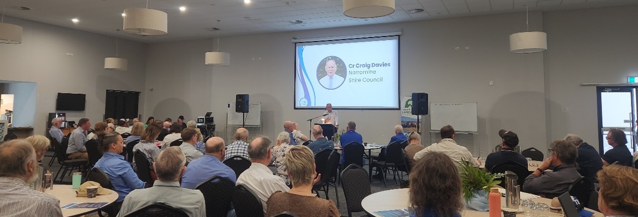
The first project to be hosted by the Initiative is the Upper Namoi Water Symposium attended by more than 100 key stakeholders on Monday March 17, 2025 at the Mercure Tamworth.

This event provided an important opportunity for water users and policy makers to discuss their issues and concerns, to explore how different water interests could be affected, and start the journey to co-design solutions that will ensure ongoing water availability and sustainability for the Upper Namoi.

Watch NBN News coverage of the Water Symposium HERE

JOIN THE CONVERSATION
Sign-up to receive updates from the Upper Namoi Water In The Landscape Initiative
JOIN THE CONVERSATION Sign-up to receive updates from the Upper Namoi Water In The Landscape Initiative


Further background

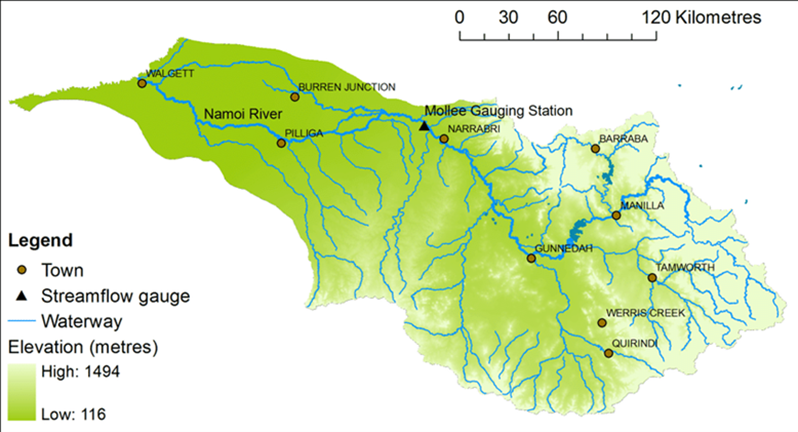
The Upper Namoi watershed is framed by the Great Dividing Range to the east and north-east, the Liverpool Range to the south and the Nandewar Range to the north. This landscape is less than 10% of the greater Namoi catchment but catches more than 80% of the water that flows to the Murray-Darling system via the Namoi River.

While engineered water infrastructure assets such as Chaffey, Keepit, and Quipolly Dams have traditionally supported Namoi communities and stakeholders, the health and viability of Upper Namoi communities and stakeholders is ultimately dependent on groundwater.

According to NSW Government information, groundwater contributes around 20% of the total water needs in NSW, meaning that a significant portion of the water filling dams in the state is sourced from groundwater, particularly in areas where surface water is less reliable during droughts

The Upper Namoi cannot continue to depend solely on big, expensive open dams that lose a considerable percentage of their storage to evaporation, and are all becoming progressively shallower because of sedimentation

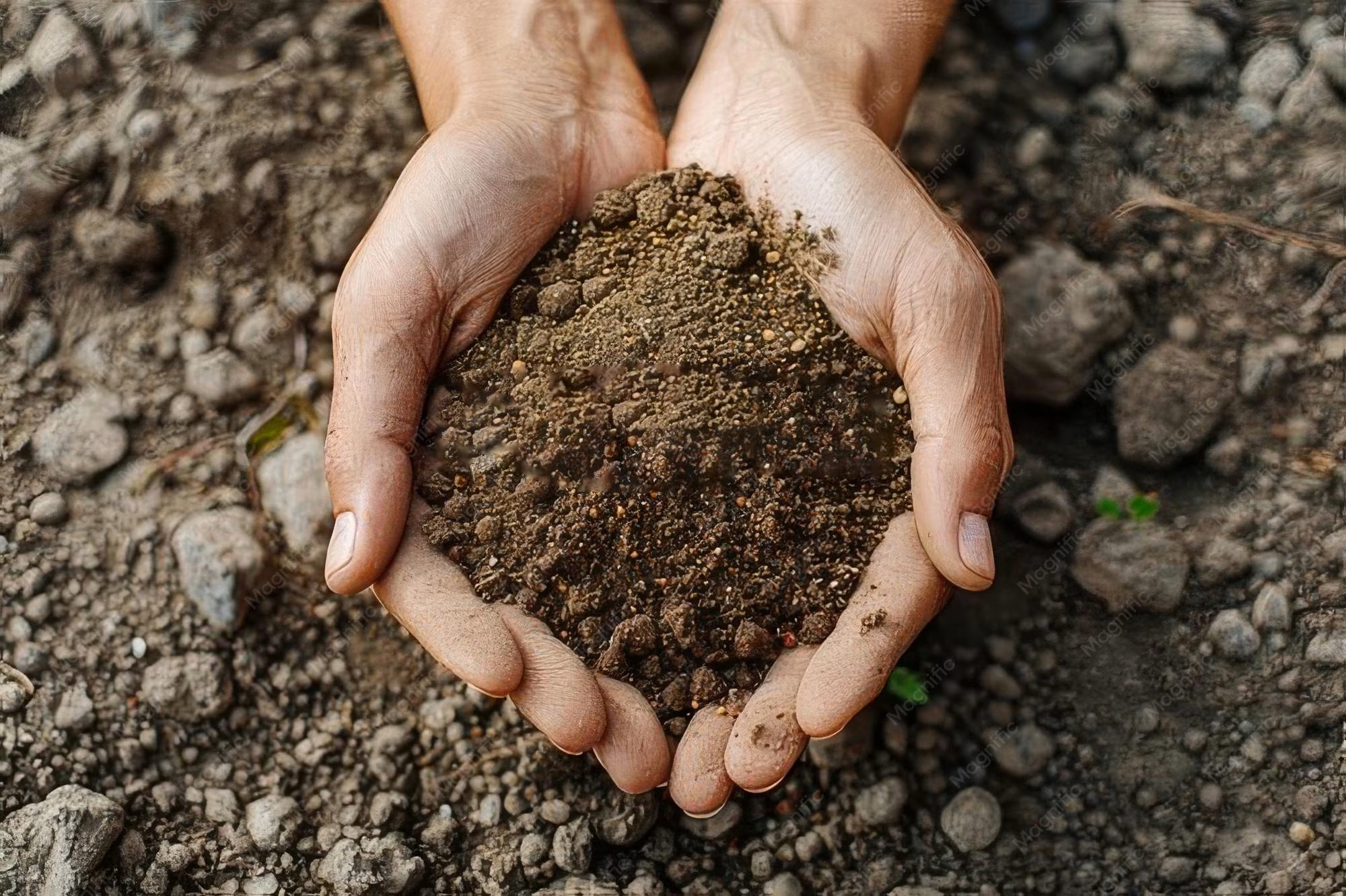
The Alliance believes there is a critical need to start thinking about how the Upper Namoi can keep water more safely stored in the landscapes where it falls – in soils and aquifers where it is less prone to evaporation; even in vegetation that helps cool the landscape and slow evaporation

The more water that is held in the landscape and slow on its journey to the sea or back into the atmosphere, the more we have to sustain people, enterprises and the environment in times of stress.

UNE have determined there is “strong scientific certainty” that north-western NSW is going to grapple with more acute water shortages as global temperatures continue to rise.

Surface and underground water is fundamental to all Namoi water users and stakeholders and the strategic plans of the local government areas (Tamworth, Liverpool Plains, Narrabri and Gunnedah) identify the importance of water security and resilience to our region.

Land management in agriculture, business and every-day life affects groundwater conditions and extraction; it influences surface retention and downstream flow, and so is significant for both droughts and floods. 

Historically, the focus of policy, resource allocation and public attention has been on the lower Namoi and the Murray Darling Basin (MDB), ignoring that downstream waterways rely fundamentally on how much water is in the upstream landscape.


If you would like to learn more about WITLY and the purpose of the symposium, please find additional information below.
Background Briefing Background Briefing Murray-Darling Basin Plan mark II Murray-Darling Basin Plan mark II Social Covenant Social Covenant Consultation Draft Consultation Draft


Latest News


Community Tree Planting for the Whole Family

The Friends of Moore Creek Caves Reserve

Invite You
 
To a community family friendly tree planting morning
In the reserve at the end of Maysteers Lane
(off Moore Creek Road)

On Saturday 17 May 2025 between 9:00am and 12:00


Financial Literacy and Investing in Natural Capital Sessions – Build Financial and Natural Wealth for Your Farm

North West Local Land Services in partnership with Principal Economist Janine Powell from AgEcon invite you to gain a deeper understanding of the financial advantages of managing natural capital on your farm at workshops located in Tamworth (20 May) and Narrabri (27 May).

The sessions will explore:

• monitoring your farm’s financial and enterprise performance

• understanding the link between natural assets and financial outcomes

• local farm case studies on assessing natural capital

• an update on natural capital markets

• Local Land Services natural capital service


This workshop will equip you with practical tools and insights to strengthen your farm’s financial resilience while enhancing its environmental sustainability.


Landcare Learning - A prickly problem

Got a prickly problem on your patch? Join us May 20 to learn how to spot, stop, and manage invasive cacti with Harrisia Cactus Project Officer Debi Bancroft!


Carbon Farm Field Day

Interested in Carbon Projects but have been waiting to see what it looks like on farm?  Now's your chance.  Atlas Carbon in partnership with NSW Government and Wilmot Cattle Co will be holding an on farm field day in Nundle on 17th June.  Bookings now open!


North West Local Land Services May 2025

Stay up to date with the latest events, make sure you check out the North West Local Land Services website, newsletter and socials. Other events pop up that are not currently listed so it is a great way to stay up to date with following links listed below.

Where have the Bogong Moths gone?

Where have the Bogong Moths gone?

Bogong Moths usually migrate in spring each year, especially from southern Queensland, central NSW and western Victoria to the Australian Alps, and then back again in autumn. Recent research suggests they may also be in South Australia, Western Australia and Tasmania, but more data is needed - including via Moth Tracker.

Bogong Moths are facing a number of threats, including extreme weather events, drought and climate change, light pollution on their migration routes, changed wide-scale agricultural practices and insecticides, predation by introduced species and habitat loss. Following an estimated 99.5% collapse, Bogong Moths were added to the IUCN Endangered Species list in December 2021. Scientists are currently working hard to understand more about the decline of Bogong Moths and how to protect the species, so with Moth Tracker, we can all do our bit to help!

During the Bogong Moth’s spring to summer migration in 2023, we received 594 moth sightings on Moth Tracker, with 291 of those confirmed to be Endangered Bogong Moths. To all the Moth Trackers out there, thank you for your support!

A map of Victoria, Australia showing the Bogong Moths' annual migration route from NS and SA down to Victoria's alpine region

Have you seen a Bogong Moth? Submit your sighting on Moth Tracker https://mothtracker.swifft.net.au/

 And please turn off your outside lights so they can keep flying!!!

Photo by By Donald Hobern from Canberra, Australia - Agrotis infusa, CC BY 2.0, https://commons.wikimedia.org/w/index.php?curid=4936674


Upcoming events in the North West


Check out these upcoming events in the North West.

Bendemeer Students Join the TreeTroff Biodiversity Project

Bendemeer Students Join the TreeTroff Biodiversity Project

This week, I had the pleasure of visiting Bendemeer Primary School to talk to Years 3 to 6 students and their teacher, Mrs Doak about the exciting TreeTroff in Schools program. We explored the origins of the project, what it means for their school, and even selected the best location and tree for the installation — a great step forward in bringing the program to life at Bendemeer.

The TreeTroff project is part of the Koalas and Others 2025: A Schoolyard and Community Biodiversity Project, coordinated by the Warrumbungle National Park Environmental Education Centre (WNPEEC). It's an innovative citizen science initiative that helps schools monitor local biodiversity using cameras and data collection tools. Students gain valuable digital, scientific, and communication skills as they analyse images, record data, and prepare scientific reports each semester to share with other participating schools across the region.

The project provides long-term data that supports conservation efforts and is of interest to universities and government agencies.

We're looking forward to seeing Bendemeer students actively engaging in this hands-on conservation science and sharing their findings with schools across the state.

Help achieve more sustainable and resilient rural landscapes

Help achieve more sustainable and resilient rural landscapes

Have you undertaken native revegetation on your farm in the past?

Researchers from Western Sydney University, the University of Tasmania and their collaborators want to hear about the outcomes. We invite you to participate in our study by completing a brief on-line survey, site visit and interview. Eight lucky survey participants will receive prizes valued at over $1000 and an opportunity to share and learn from other land managers interested in ensuring sustainable and resilient rural landscapes around Australia.


If you have any queries about this study, please contact e.sumner@westernsydney.edu.au or call 0497 784 310. This study is funded by the National Environmental Science Program and the NSW Department of Climate Change, Energy, the Environment and Water

Our members often say that when you become part of Landcare, you’re not just joining a group, you’re becoming part of a family. The concept is so compatible with Australian culture it’s hard not to get involved! By becoming a TRLA member, you’ll be supporting our work, learning new skills, becoming part of the solution, and helping to make a difference for the future.

LEARN MORE LEARN MORE

together we can make a difference

funding support

Did you know (TRLA) run an Annual Small Grants program for Landcare activities connected to the Tamworth region.

Volunteer Landcare and Grassroots Community groups can apply up to $2,500 for activities that meet an objective of TRLA’s strategic plan with eight successful projects being awarded funds from across the region.

APPLY NOW APPLY NOW